
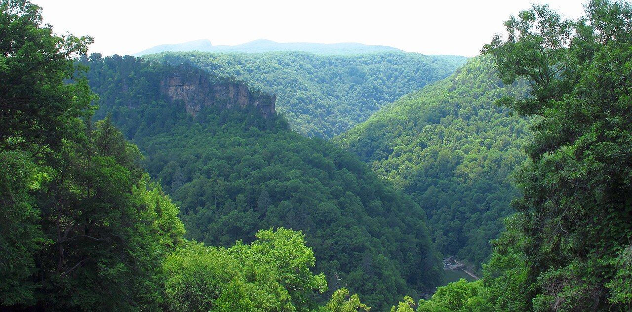

After a day of courthouses, graves and coal towns, Breaks Interstate Park is a change of scale. Here the Russell Fork of the Big Sandy has cut through Pine Mountain, carving a gorge about five miles long and well over a thousand feet deep at its deepest. Locals and park promoters call it the Grand Canyon of the South. The comparison is generous, but standing at the rim on a clear morning, you understand why people make it. From the overlooks the river looks small and quiet far below, yet the same water turns loud and fast when the dam upstream releases it. Give the view time: the colours on the cliffs change with every hour of light, and the quietest moments come early, before the parking areas fill and the first walkers set off along the rim trails.
A park shared by two states
The park straddles the border between Kentucky and Virginia, and it is run jointly by both states through a compact approved by Congress. It opened in the 1950s and covers several thousand acres of forest, cliffs and river. It is one of very few interstate parks in the country.
The main entrance and most facilities are on the Virginia side, though the gorge and its trails reach into Kentucky. The park lies roughly thirty miles southeast of Pikeville, which makes it an easy detour from the McCoy side of feud country. For the town on that side, see our Pikeville guide.
The gorge and the overlooks
The Russell Fork found a gap, or break, in Pine Mountain, and over a very long time it cut down through layers of sandstone and shale. The result is a winding canyon with sheer cliffs, rock outcrops and steep forested slopes. The name of the park comes from that break in the mountain wall.
Several overlooks along the park road give different views into the gorge. Some look straight down to the river; others look across to the rock walls and the ridges beyond. Most are a short walk from a parking area, which makes them accessible to nearly everyone. Early morning often brings mist in the gorge, which lifts as the day warms; late afternoon light picks out the color of the rock.
The Towers
The best-known feature is the Towers, a long, narrow ridge of rock rising from the bend of the river below. From the overlooks it looks like a fortress wall wrapped in forest, with the river curving around its base. It is the image you will see on most park literature, and it is worth time with binoculars to pick out the cliffs and ledges.
You are looking at rock that has been exposed and shaped by the river over a very long period. The sandstone resists erosion better than the softer layers around it, which is why the ridge stands out so sharply.
Another stop · Tug ValleyDriving feud country: a sensible two-day routeTrails and the river
The park has a network of hiking trails, from short paths along the rim to steeper routes that drop toward the river. Some pass rock shelters, springs, rhododendron thickets and old-growth corners. Trail lengths and difficulty vary, so pick up a current map at the visitor center and check which trails are open; storms and rockfall can close sections.
- Stay on marked trails. The cliff edges are unfenced in many places, and the drop is serious.
- Allow for the climb back. Any trail that goes down into the gorge has to come back up.
- Watch the weather. Wet rock and leaves make steep sections slick.
- Carry water. Summer humidity in the gorge can be draining.
The Russell Fork itself is known among experienced paddlers for difficult whitewater, especially during scheduled releases from a dam upstream, usually in the fall. These runs are for skilled boaters only. If you are not one, the overlooks are the safe place to watch. Release schedules and rules are set by the managing agencies.
Staying and planning
The park has a lodge, cottages, a campground and a visitor center run by the park itself, along with picnic areas and a small lake. Facilities, seasons and reservation rules change. Some services close or reduce in winter.
Spring brings wildflowers, redbud and rhododendron in bloom along the trails, and it is a fine time for a visit. October is the park's peak: the gorge fills with color, and the air is clear. Summer is green and busy, with haze some days. Winter offers bare-tree views deep into the canyon, but icy roads and trails can be a problem.
Fitting the park into a feud-country drive
The Breaks are not part of the feud story, but they belong to the same mountains and the same rivers. The Russell Fork is a tributary of the Levisa Fork, which joins the Tug Fork to form the Big Sandy. Many visitors use the park as a breathing space between the historical sites, or as an overnight stop on the way in or out of the region from the south.
A sensible order is to drive from Pikeville to the Breaks in the morning, spend the middle of the day on the overlooks and a trail, then return north in the afternoon. Mountain roads in this area are narrow, with sharp curves and coal trucks, so allow more time than the map suggests. For a full plan that links the park with the feud sites on both sides of the Tug, see our driving plan.